
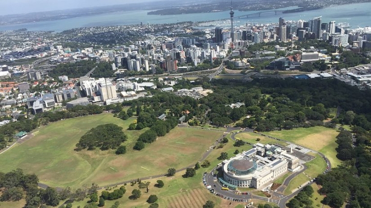
We know that Auckland is a big part of the country’s economy. In 2018 it had 35% of the population, 36% of the jobs, and accounted for 38% of GDP – up from 31%, 32% and 34% respectively in 2000.
But just how big is that really? In the maps below I’ve tried one way to make it a bit more concrete.
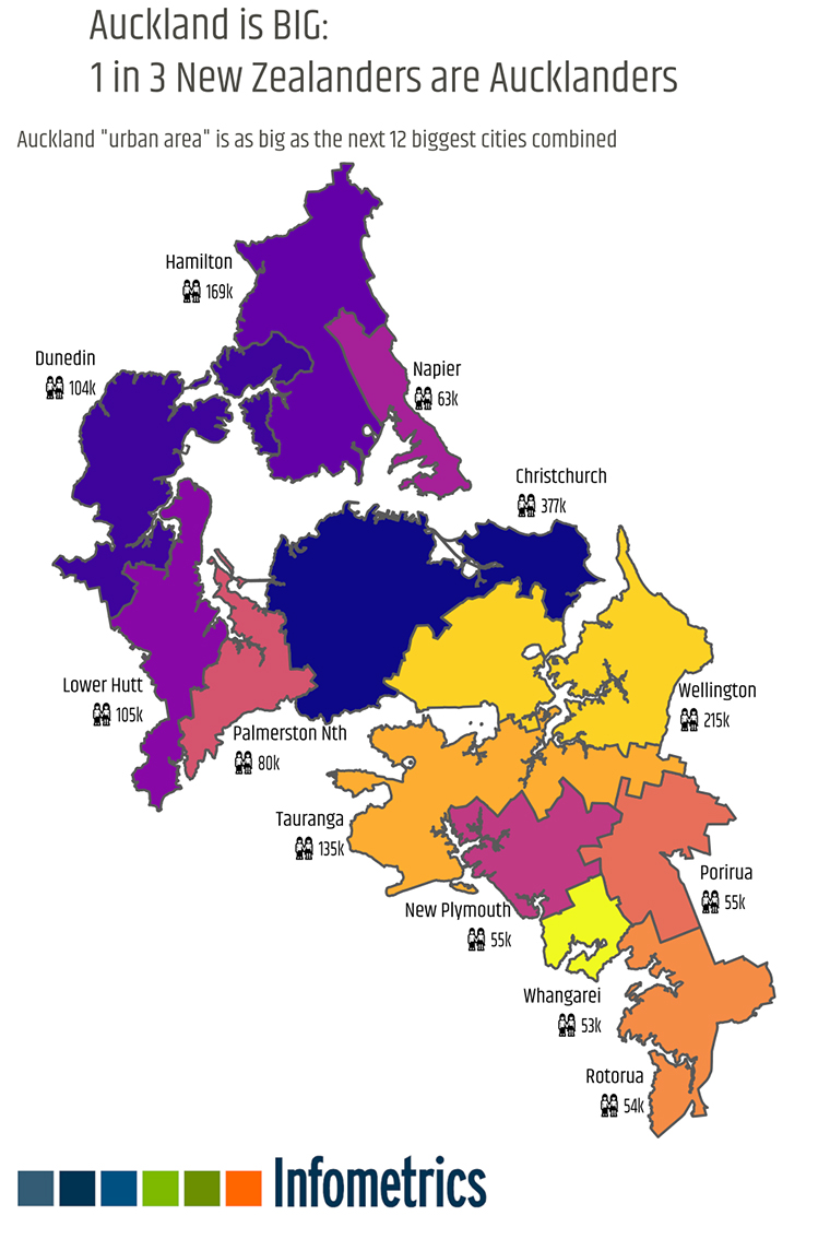
The main Auckland urban area, according to Stats NZ’s new geographic classification, has the same population as the next 12 urban areas combined: Christchurch, Wellington, Hamilton, Tauranga, Lower Hutt, Dunedin, Palmerston North, Napier, Porirua, New Plymouth, Rotorua, and Whangarei.
The first map divides the Auckland urban area into 12 areas with the same populations as these cities.
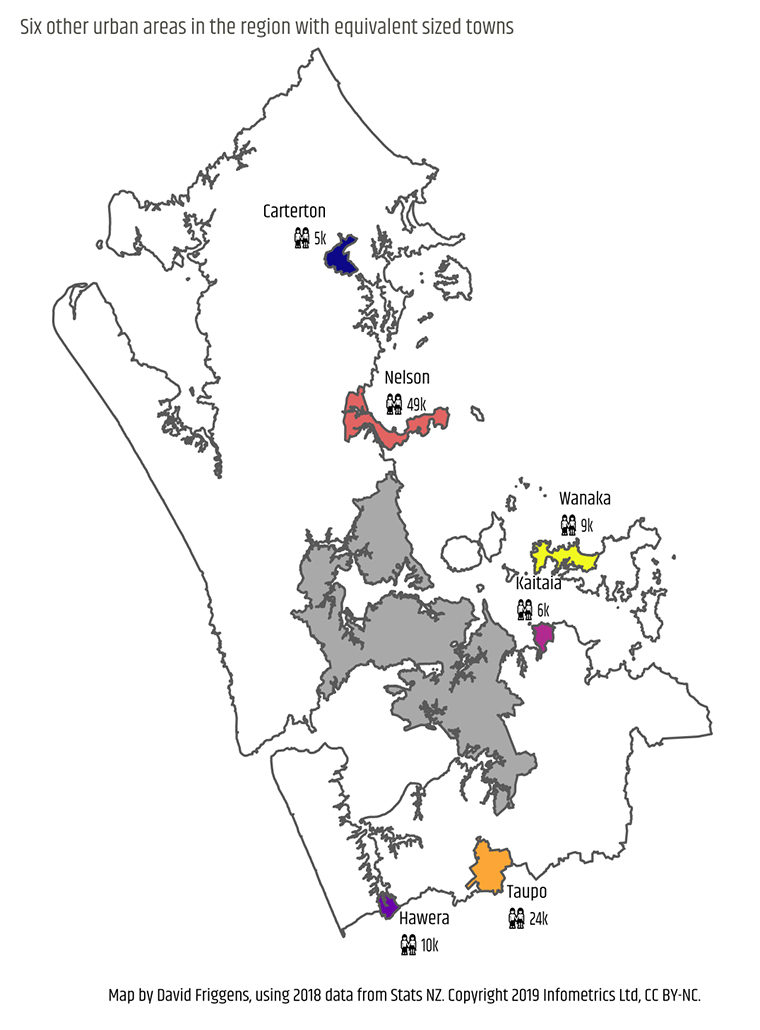
The second map notes that there are six other urban areas in the Auckland region with populations over 5,000 and labels them with the names of equivalent sized towns; Warkworth is paired with Carterton, Hibiscus Coast with Nelson, Waiheke West with Wanaka, Beachlands-Pine Harbour with Kaitaia, Pukekohe with Taupo, and Waiuku with Hawera.
Outside of the seven urban areas noted in the maps there are still 121,000 people living in the remainder of the Auckland region – that’s slightly more than the whole of the Taranaki region.
Our Regional Economic Profile has long allowed people to compare an area with other regions or territorial authorities, or the with the whole of New Zealand. Some clients have asked for the option to compare with the rest of New Zealand outside Auckland, since it’s so big – we’ve recently made “New Zealand excl Auckland” a comparison option for everyone. We’ve also recently developed a Small Area Framework that complements the Regional Economic Profile and allows subscribers to explore economic data for the urban areas and “Statistical Area 2” areas (similar to the old Area Units) within a particular region or territorial authority.
Small print: The map omits the Barrier Islands for space; their population is a little over 1,000. Hibiscus Coast’s population is 52,000 so is closer to Whangarei than Nelson, but I didn’t want to use that twice.
3 Comments
Greater Christchurch will reach 500,000 in the next year or two. The big and fast growing satellite towns of Lincoln, Prebbleton, Rolleston, West Melton, Rangiora, Pegasus and Kaiapoi that are in Selwyn and Waimakariri should really be considered part of Christchurch.
To be fair to Wellington its urban area extends far further than its municipal boundaries too.
We welcome your comments below. If you are not already registered, please register to comment.
Remember we welcome robust, respectful and insightful debate. We don't welcome abusive or defamatory comments and will de-register those repeatedly making such comments. Our current comment policy is here.