
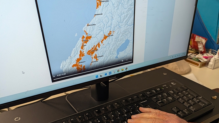
Interest.co.nz has updated its urban sprawl animations which show in an interactive visual format how New Zealand's major cities have spread outwards each year from 1870 until 2026.
There are separate sprawl animations for Auckland, Hamilton, Tauranga, Wellington, Christchurch and Dunedin based on Land Information NZ data to show the spread of residential land into the surrounding countryside, starting with the first tiny settlements and growing into the current sprawling cities.
They also show how residential development has spread beyond city centres to outlying areas, such as Warkworth on Auckland's northern boundary and Pukekohe on its southern edge, and illustrate how quickly development sped up after the Second World War.
You can access the interactive maps below, or via the Urban Sprawl tab in the property section.
Auckland metro
Hamilton
Tauranga
Palmerston North
Wellington metro
Christchurch metro
Dunedin
These visualisations were developed by OpenGeo - http://opengeo.co.nz
[If these visualisations don't load on the page above, download them using the option at the right of each city embed, like this
We welcome your comments below. If you are not already registered, please register to comment
Remember we welcome robust, respectful and insightful debate. We don't welcome abusive or defamatory comments and will de-register those repeatedly making such comments. Our current comment policy is here.