
New Zealand’s flood risk is increasing, a natural hazards and hydrodynamics expert says, and not just in places where people can remember floods happening before.
“This is partly due to climate change - we know rainfall intensity is increasing across Aotearoa, with more rain falling in shorter periods. Rapid urban intensification is another contributing factor,” Emily Lane , principal hazards scientist at Earth Sciences NZ, says.
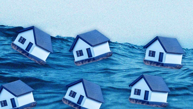
Lane’s comments come as research led by Earth Sciences NZ published on Thursday found that over 750,000 New Zealanders live in places exposed to flooding from one-in-100 year rainfall flooding events.
People aren’t the only thing affected by this exposure with the research showing around $235 billion worth of buildings across the country are exposed to flooding under New Zealand’s current climate along with 26,800 kilometres of road, 21% of electricity sites such as substations, and 14,100 kilometres of stormwater pipes.
And these figures would rise if there was an increase in warming.
There were also regional differences - the research found 8% of people in Taranaki are exposed to one-in-100 year rainfall events under the current climate, while for those in the West Coast, 38% of people are exposed.
The findings come from a five-year research programme looking at flood risk across Aotearoa and involved collaborating with councils, universities, central government agencies, industry and other research organisations.
As part of this programme, a nationally consistent flood hazard map was created. Earth Sciences NZ says it’s the first time rainfall flood maps covering different regions of the country can be viewed in a single online tool.
It also shows different climate change scenarios - where the climate is 1C, 2C and 3C warmer.
Earth Sciences NZ principal climate scientist Sam Dean says: “Increasing extreme rainfall due to climate change is one of the biggest and most impactful hazards faced by New Zealand.”
“The building of our towns and flood defences have been shaped by historical floods that are no longer a reliable guide to the future,” Dean says.
“Predicting how flood risk is going to change is important to ensure we can protect people and places that we value in the most cost-effective way.”
University of Waikato professor Iain White and associate professor Silvia Serrao-Neumann were also involved in the research.
Serrao-Neumann says: “Flood risk management is handled differently in different regions, and, to date, there’s no consistent way to assess current flood risk or how this might change under climate change.”
“Local and regional governments also vary in how they manage and reduce these risks. Our research helps to address this by providing a consistent and coordinated approach to understanding, measuring, and communicating flood risk at a national-level.”
White says the map provides “the foundation on which to build national-scale resilience”.
“Providing certainty to decision makers will help avoid passing liabilities to current and future generations.”
Earth Sciences NZ hazards researcher Ryan Paulik told RNZ that cost was a major barrier to adaptation in some places.
"With lower ratepayer base, then the ability to afford structural or non-structural interventions to reduce flood risk or manage flood risk, there's fewer options unless that funding can be sourced."
Rates cap ‘flexible where it needs to be’
Local Government Minister Simon Watts is planning to take a policy proposing a model for capping local council rates to Cabinet before Christmas.
When asked about Paulik’s comment, Watts told interest.co.nz: “I am focused on designing a rates capping system that enables councils to collect sufficient revenue for their role in helping us build out of our infrastructure deficit including for flood protection.”
“We will make sure that our rates cap is flexible where it needs to be, to support a flexible funding system for a flexible planning system, ensuring that councils can play a supportive role for the infrastructure we need," Watts says.
Watts, who is also the Climate Change Minister, says the release of this research is timely and an important reminder of the scale, cost and reality of challenges New Zealand faces from dealing with the impacts of climate-related flooding.
“My priority is ensuring New Zealanders are safe, prepared and informed. It also reinforces the importance of having an enduring and coordinated national adaptation framework which is now being implemented by the Government,” Watts says.
The Government recently announced its National Adaptation Framework which includes creating a national flood map and introducing legislation clarifying the responsibility of local government by requiring adaptation plans in the highest priority areas.
Documents on establishing a National Adaptation Framework were also proactively released, with a paper Watts took to Cabinet outlining proposals.
Alongside this was a Minute of Decision document from the Cabinet Economic Policy Committee.
In this document, the committee agreed: "The Government's intent is to move towards an end state where the Crown no longer distorts risk signals and blunts incentive to manage risk by providing financial assistance where homeowners suffer significant losses after major events (especially in the form of residential property buyouts)".
Watts says the research led by Earth Sciences New Zealand represents a stepping stone towards detailed flood mapping that is needed.
With the Government’s plans for a national flood map, Watts says: “Councils and agencies will be able to use the map to plan, respond to emergencies, and identify where better flood data is needed.”
“Planning for how to share the costs of adapting to climate change over time is also an important part of the National Adaptation Framework.
“It is a complex area and one where it is important to take the time to get things right. This is why we have decided to take decisions in the next term of Government.”
Watts says local government has an important role to play in the management of natural hazards such as “flooding and slope instability, through hazard mapping, risk assessment, and land-use planning rules that govern where and how development occurs”.
“Current reforms are re-focusing local government on their core responsibilities, such as reducing natural hazard risk,” he says.
“In the meantime, the Government retains discretion to provide support for genuine hardship, including considering buyouts where that is the most cost-effective option following severe weather events.
“However, it is not likely to provide financial assistance to homeowners based on full pre-event property valuations.”
4 Comments
I’ve never understood the concept of a rates cap. Councils are democratically elected, a rates cap prevents them doing what they were elected to do.
Since the 2003? local govt Act empowering "powers of general competence" in matters well beyond their historical role, elected council members have increasingly been in thrall to their unelected CEOs &self serving bureaucratic empires.
Other people's money.
Or all peoples desires/needs
"From each according to his ability, to each according to his needs"
Karl Marx
We welcome your comments below. If you are not already registered, please register to comment
Remember we welcome robust, respectful and insightful debate. We don't welcome abusive or defamatory comments and will de-register those repeatedly making such comments. Our current comment policy is here.